Hiking Trail in The Smokies

ART LOEB TRAIL [MAP]
Length: 12.3 miles Rating: Strenuous
The Art Loeb Trail, 30.1 miles long, is a national recreation trail and named after a local hiking enthusiast. The trail traverses beautiful, but rugged terrain, from some of the lowest, to some of the highest points on the Pisgah District. Most of the Art Loeb Trail is overlapped by the Mountains-to-the Sea Trail. It begins at the Davidson River and climbs steeply to Shut-in Ridge. Once up, don’t expect that the hard part is over. This trail will take you up and down knobs, along ridges and down into several gaps.
Directions: Go 0.2 mile south of Pisgah District Ranger Station on U.S. Highway 276, and turn onto the road to Davidson River Campground. Park in the Art Loeb Trailhead parking lot. The other end of this section is at Gloucester Gap on FS Rd. 471, where overnight parking is not recommended.
SMOKEMONT LOOP TRAIL [MAP]
Length: 5.9 miles loop. Rating: Moderate
An easy loop trail loop trail near Cherokee. A wooded and creekside, Its cool in the summer, but the low elevation does not offer much in the way of views. It takes an average of 3 hours to complete. Not a heavily traveled trail, it offers solitude during quieter times of day.
BUCKEYE RIDGE TRAIL
Length: 5.4 miles Rating: Moderate
This hiking trail winds through grassy fields and wooded areas. It provides panoramic views of the countryside in some spots. Cold Springs Creek Flows through dense woods and grassy fields on its way to the Pigeon River. The forest shows hints of its past history-farming, logging, narrow gauge railroads, settlements, and signs of recent forest management. The grassy ridges of Max Patch Mountain near the Tennessee state line crown the area. Trails combined with forest service roads to provide loop opportunities.
Directions: Take Harmon Den Exit off I-40 near the NC/TN state line. Head northeast on FR 148 (Cold Springs Road) about 3 miles to Harmon Den parking area on the left. Parking for trailers is also available at lower junction of FR 148 and 3526.
BOOGERMAN TRAIL [MAP]
Length: 4.2 miles Rating: Easy
This moderate, 4-mile hiking trail has an elevation gain of only 900 feet. It is well known for the variety of magnificent trees. The trailhead is on Caldwell Fork Trail. After leaving Caldwell Fork, the trail ascends a low ridge to a gap, slabs (runs across the mountain slope with only gradual elevation change) the mountainside with only two additional short climbs, reaches a side ridge, and descends back to Caldwell Fork. It is best to do this trail as a day hike from Cataloochee Campground, a 7.5-mile roundtripa
Directions: Take exit 20 off I-40 (Cove Creek) and travel west on NC 276 turn right on Cove Creek road. Stay on Cove Creek Rd. for 6 miles. This will take you 2 miles beyond park boundary. Turn left on Cataloochee Road, go 3.1 miles. Trail will be on the left.
Alum Bluff Trail to Mount LeConte [MAP]
Length: 11.2 Miles Out and Back. Rating: Moderate
Alum Bluff trail is one our very favorite hikes. It features creekside hiking, caves, walking bridges, scenic views. You can stop at the cave and turn around or continue up to the top of Mount LeConte. If it's cloudy at the top your views will be limited, but if the sky is clear you'll be treated to a view from the second highest peak in North Carolina. It is a strenuous hike because of the steep elevation change. Consider the hike to the cave as a half day and round trip to the op a full day hike so prepare accordingly. Parking lot fills up early and starting 2023 you need a parking tag.
Big Creek Trail [MAP]
Length: 5.5 Miles round trip, Difficulty: Easy
Big Creek Trail, in the the Park a 5.5 mile roundtrip hike, you get to hike through a heavily wooded forest, alongside one of the largest and fastest flowing creeks in the park, while visiting two waterfalls.
Boogerman Trail [MAP]
Length: 8 Mile round trip, Difficulty: Moderate
This is nearly 8 mile roundtrip and moderate - strenuous hike is full of history, creeks, dense old-growth, and some of the largest trees you'll see in the Great Smoky Mountains National Park.
Clingman's Dome (3 Trails) [MAP]
Clingman's Dome is one of the highest points east of the Mississippi at 6,643 and the tallest mountain in Tennessee. Clingman's Dome Trail will take you to the top and observation tower for incredible 360 degree views. If you want to go with the path less traveled, at the trail head go left on the Andrews Bald Trail. It's about a 3 mile round trip but the views from the bald are incredible, especially at sunset. A note on the latter, remember a flash light. Also from the Clintons dome trail about a 1/4 mile up on the left is the Appalachian Trall crossing. Go left here and you can walk the crest of the ridge between North Carolina and Tennessee. A good turn around point is Siler's Bald at about 2.5 miles out. The trail has some flat spots but is mostly going down on the way out and up on the way back so pace yourself.
Craggy Gardens Pinnacle Trail [MAP]
Length:1.1 Miles. Difficulty: Easy
The most popular, and beautiful trail at Craggy Gardens, this short but somewhat steep hike offers tremendous 360 degree views of the surrounding Blue Ridge mountains.
Deep Creek Loop Trail [MAP]
Length: 4.6 Miles, Difficulty: Easy
This moderate loop trail is a 4.6 mile hike that will take you through the lush Deep Creek area (Bryson City) of the Great Smoky Mountains National Park and to 3 separate waterfalls. In the spring and fall the colors and flowers are outstanding.
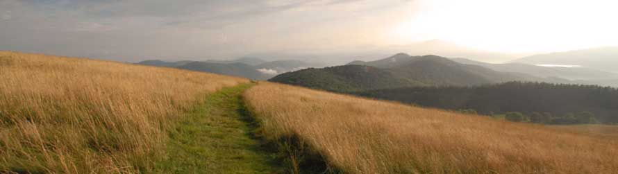
Max Patch [MAP]
Length: 1.5 Miles, Difficulty: Moderate Climb
This 1.5 mile hike along the Appalachian Trail provides stunning and long range 360 degree views of the Blue Ridge Mountains. The grass covered fields at the top provide a wonderful location for picnics, playing, and kite flying.
Little Cataloochee Trail [MAP]
Length: 12.2 Miles Out and Back. Difficulty: Easy
Little Cataloochee Trail in Cataloochee Valley, is a beautiful and historic trail, full of scenic forest, creeks, and historic homes of the last people to live in the Park. The highlight of the hike is Little Cataloochee Baptist Church. This is is a relatively easy hike.
Little River Trail [MAP]
Length: 12.3-mile out-and-back, Difficulty Moderate
Little River Trail, located in the Elkmont area of the Great Smoky Mountains National is a fun trail full of interesting history, and has an optional loop hike, and small waterfall.
Purchase Knob
(Closed Indefinitely) Close to Maggie is Purchase Knob. Featuring high elevation views, historic buildings, and access to a number of other fantastic trails and views. Be sure to take a map along since there are quite a few criss-crossing trails that can be explored.
Rainbow Falls Trail [MAP]
Length: 5.1 Miles to the waterfall and back, 12 miles to Mount LeConte and back. Difficulty: Strenuous
This is another half day or whole day hike depending on how far you go. It starts from the Roaring Fork Motor Trail just in the park near Gatlinburg, TN. The trail is moderate to the falls and step if you continue to the top of Mount Leconte (Same destination as the Alum Cave Trail). For the well planned you can be dropped off at Alum Cave Trail, hike to the top and down the Rainbow Falls trail and be picked up there later in the day, while your driver can spend the day shopping in Gatlinburg.
Rough Fork Trail [MAP]
Length: 12.3-mile out-and-back. Difficulty: Easy
This 4-mile roundtrip hike through hemlock woods in Cataloochee Valley. It takes you up to the historic Woody House. A very nice easy trail, that is great for kids.
BLUERIDGE PARKWAY HIKES
Milepost 418.8: GRAVEYARD FIELDS
Length: 3.2 miles Rating: Easy
This is a popular family hiking trail because of its beauty and ease. This is a moderate climb of almost a mile to the base of an impressive waterfalls. A map at the parking area shows the Graveyard Fields trail system. The set of steps to the right of the map is the start of the trail. After crossing the bridge, the main trail goes left and upstream. A 0.25-mile trail to the right will take you to the bottom of the Lower Falls, which is a moderate descent. Rocks around waterfalls are very slippery. The main trail will take you through open, grassy areas, and past nice pools for wading on a hot summer day. Blueberries are abundant in the fall. After one mile, you will see the trail to the Upper Falls. The main trail crosses the Yellow stone Prong and returns to the parking lot.
Directions: This trail begins at the Graveyard Fields Overlook on the Blue Ridge Parkway. From the U.S. Highway 276 junction with the parkway, turn left or south on the Parkway and continue to milepost 418.8 (about 6 miles).
Milepost 420: Black Balsam Knob
This section of trails includes some of the most spectacular mountains and balds in the Southern Appalachians, including Black Balsam Knob, Sam Knob, and Tennent Mountain. These treeless mountaintops draw people from afar due to their sweeping views and alpine appearance.
Milepost 422.4: Devil’s Courthouse
According to Cherokee folklore, the devil holds court in a cave on the mountain, where a walk to the bare rock summit is worth every step.
Milepost 431: Richland Balsam Overlook
The highest point on the entire Parkway at 6,053 feet, the Richland Balsam overlook also offers a beautiful 1.5-mile self-guided loop trail.
Milepost 451.2: Waterrock Knob
Waterrock Knob Visitor Center sits at nearly 6,000 feet and offers exhibits, book sales, restrooms and a 1.2-mile roundtrip trail leading to the summit of Waterrock Knob for an almost 360-degree view of the Smoky Mountains.
Flat Creek Trail Access off Hientooga Road [MAP]
An amazingly beautiful 5.2 mile moderate round trip hike located just off The Blue Ridge Parkway, in the Great Smoky Mountains National Park. Full of wildflowers in the spring.